Aerial Surveying & Geospatial Solutions

Our company specializes in cutting-edge Drone and SLAM (Simultaneous Localization and Mapping) technology to provide highly accurate, efficient, and cost-effective mapping and surveying solutions.

Find out how!

Hire Us For

Drone Mapping

High-resolution aerial imagery and photogrammetry for accurate topographic maps, orthophotos, and 3D models

SLAM (Simultaneous Localization and Mapping)

Real-time, highly accurate indoor and outdoor 3D scanning for detailed site mapping and modeling

Land Surveying

Traditional and advanced survey methods combined with drone and SLAM technologies to provide precise boundary delineation and land assessments..

About Us

We are Licensed Surveyors and UAV Pilots specializing in Drone & SLAM Mapping and Land Surveying. With proficiency in a wide range of CAD, LiDAR, and Photogrammetry applications, we provide precise and reliable geospatial data for critical development projects worldwide.

Mission.

Our mission is to provide innovative, data-driven geospatial solutions that empower businesses and organizations to make informed decisions, enhance operational efficiency, and drive sustainable growth.

Vision.

To become a global leader in geospatial services, transforming how industries access, analyze, and apply geographic data.

Your Trusted Partners

Highly Motivated Team with Innovative Ideas

We are your trusted partners you can count on. We love what we do and are committed to providing industry leading services in the Surveying and Geo-spatial niche.

Why Choose Us?

Why Hire us for your Aerial surveying and Geospatial solutions needs?

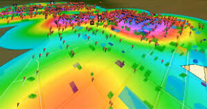
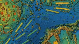
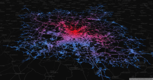
With over 12 years of industry experience, our company stands at the forefront of cutting-edge aerial surveying and geospatial solutions. We specialize in advanced technologies such as LIDAR and drone mapping, offering precision and efficiency that traditional methods can’t match.

Our team combines deep technical expertise with an unwavering commitment to accuracy and quality, ensuring that every project is completed on time and within budget.

Whether you’re looking for detailed topographical data, high-resolution 3D models, or comprehensive geospatial analysis, we bring unparalleled insight and innovation to the table. Trust us to provide tailored solutions that meet your unique needs, backed by over a decade of proven success in delivering exceptional results..

Have a Project in mind?

Our Drone and SLAM Mapping services allow clients to bypass traditional, time-consuming surveying methods. By leveraging state-of-the-art technology, we deliver rapid, highly detailed data with unmatched accuracy— Reach out to us today.

Join our email list to receive updates

Email
The form has been submitted successfully!
There has been some error while submitting the form. Please verify all form fields again.